
Kern County Street Directory by Address
A Kern County street directory search is a chain, not a single lookup. The address first becomes an APN or ATN clue through the Assessor. GIS then places the parcel in relation to nearby parcels, roads, canals, and map lines. Title evidence comes from the Recorder's party index, an in-office APN kiosk, or a reliably known legal name. A restricted voter route may confirm only the person who authenticates, while a criss-cross volume can supply a historical listed name.
Keep the order of the trail clear. Address to APN is a parcel match. APN to title is an ownership or recorded-party question. Title to a household is not automatic. The street directory becomes more useful when each step keeps its date, source, and access rule attached.
- Normalize the address as a situs address, then run the Assessor search without the street type, city, or ZIP. Capture every plausible APN or ATN.
- Open the Kern GIS viewer, locate the matching polygon, and click nearby parcels one at a time. Record the situs and parcel clues separately.
- Use the Recorder party index for a known name, or use an office kiosk for APN research. Confirm a party against the legal description and instrument.
- Use California voter access only for an approved purpose or an authenticated self-check. It is not a public street roster.
- For past households, move to the Library of Congress criss-cross runs and the Beale shelf, using the period street spelling and number.
Kern County Address Search Fields
The Kern Assessor Property Search accepts one search mode at a time. An APN uses eight or nine digits, with or without dashes. An ATN uses ten or eleven digits, also with or without dashes. The address mode accepts a partial or full street and an optional number, but the county instructions say to omit the street type, city, and ZIP.
| Field label | Type | Required | Format or search note |
|---|---|---|---|
| APN Search | Text | One mode | Eight or nine digits, with or without dashes |
| ATN Search | Text | One mode | Ten or eleven digits, with or without dashes |
| Address Search | Text | One mode | Partial or full street; omit type, city, and ZIP |
| CAPTCHA | Image or text | Yes | Must pass before the search is processed |
Address matching is prefix based. A short stem can return more than one street name, and results stop at the first 100 matches. Add the house number or lengthen the street stem when the set is too broad. A parcel detail can offer a Copy Link and View Parcel Map. Owner-name search is unavailable online, and owner names are suppressed under former Government Code §6254.21, later recodified in the CPRA.
The assessor result is a parcel clue, not a household claim. Save the APN, situs, values, exemption type, and map link. A mailing address can differ from the situs address, and an exemption can suggest a record connection without proving who is present.
Kern County GIS Along a Street
The Kern Interactive County Map turns the APN clue into a visual parcel check. Accept the terms, search by address or APN, identify the target polygon, read its map tip, and open the linked parcel profile or map. Pan along both sides of the street and click adjacent polygons separately. The research did not verify a radius or buffer control, so nearby parcels should be selected one by one.
Parcel layers can expose an assessee preview, APN, situs, approximate acreage, legal type, short legal description, tax-rate area, use code, roll type, values, and exemptions. Four distributed feature classes cover land parcels, mineral parcels, map-book areas, and tax-rate areas. Parcel History tracks APN changes from September 1994, and the 2025 Final was the newest verified dataset edition. The convenience viewer is dynamic and as is; official hardcopy assessment maps control when a map dispute matters. The county's Kern GIS data page provides the dataset, format, history, and contact context behind the viewer.
The Kern tax-rate-area map entry provides a second map context for the county's parcel and tax geography.
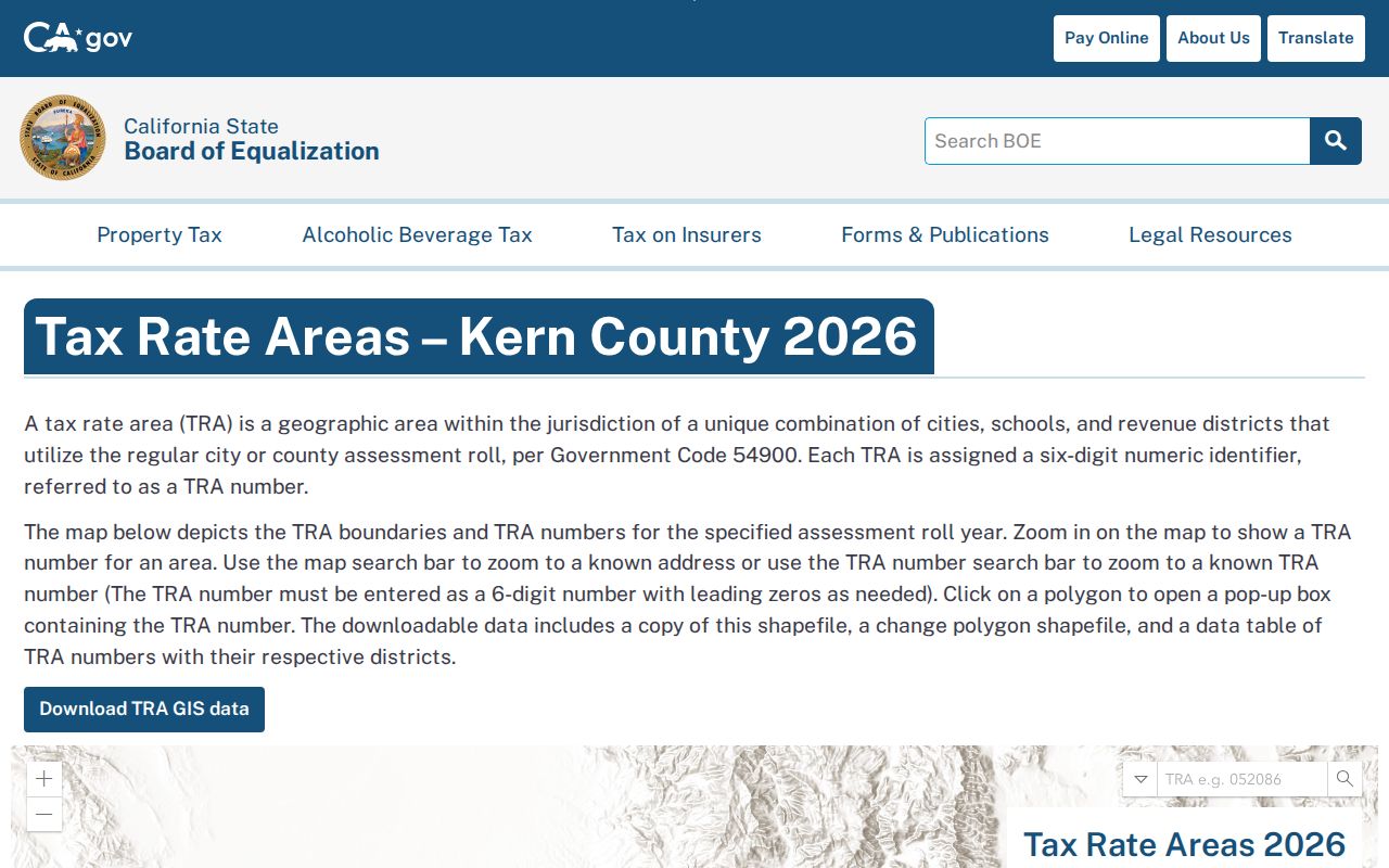
The map image is best used as a geographic cross-check. Tax-rate areas identify combinations of taxing districts, not a neighborhood identity or a complete list of people.
Kern County Street Records by Source
Each address-keyed source answers a different part of a street question. Assessor and GIS records connect a street line to land. Recorded documents identify legal parties and instrument events. A permit file can describe work and the people named in the application. Historical criss-cross pages can connect a period address to a listed name. Voter files remain restricted and cannot fill a street list for ordinary curiosity.
The record chain is stronger when the same APN, legal description, street number, and date recur across sources. It is weaker when a mailing city, return address, or first visible party is treated as proof of occupancy without the full instrument or period page.
| Record set | Keeper | What it shows | Access |
|---|---|---|---|
| Assessor profile | Kern Assessor | APN or ATN, situs, values, exemptions, parcel link | Free online search; owner names suppressed |
| GIS parcel layer | Kern GIS and Assessor | Parcel shape, map tip, assessee preview, legal and value fields | Terms-gated viewer; data editions available |
| Deeds, liens, and releases | Kern Recorder | Recorded parties, document date, type, number, and title clues | Free index; kiosk, counter, or mail for copies |
| Permit file | Relevant city or county custodian | Project address, APN, owner, applicant, contractor, and work | Custodian request; no verified countywide results portal |
| Criss-cross directory | LOC or library collection | Historical address-to-listed-name evidence | Paper or in-person research route |
Note: Parcel, title, permit, and historical address evidence should stay labeled by source because each record describes a different relationship to a place.
Kern County Street Records After December 2024
Online APN searching in the Recorder index ended on December 9, 2024. The public web route still supports party, document-number, date, and class searches, but an address-derived APN cannot be entered there in the old way. APN kiosks remain in county offices, including the Hall of Records and Recorder Annex, making the counter a practical bridge from a parcel result to a current acquisition document.
The change makes the assessor and GIS steps more important. First preserve the APN, situs, map, and legal clues. Then take those clues to the kiosk or search an independently established party name. Do not assume that the first street match is the correct parcel, especially when an address stem returns the first 100 matches or when nearby parcels share a mailing label.
- Print or save the assessor detail and parcel map link.
- At the kiosk, search the APN and compare the result with the situs and legal description.
- Record the instrument number, recording date, parties, class, and copy route before leaving the counter.
A counter search can reveal what the web form no longer accepts, but a kiosk result is still an index clue. Read the full recorded instrument or order a copy before using it to reconstruct a title trail.
Kern County Street Directory Recorder Trail
The Kern County Recorder party form uses a name field, a party-role choice, optional document-date limits, document-number ranges, a date mode, and a document-class mode. Name searches use last name followed by first name without a comma, and partial names are allowed. Initials omit periods. The class dropdown options were not exposed in the research capture, so no class list should be assumed.
- Name and role
- Search a legal name as Grantor, Grantee, or Grantor or Grantee. Search variants, trusts, and entities separately.
- Date and number
- Use a document date range or a document-number range. Up to ten individual numbers may also be accepted.
- Visible result
- Document Number, Document Date, Pages, Document Description, first Grantor or Grantee, and Image Available.
- Index mark
- R identifies a grantor and E identifies a grantee in the visible result sample. Image Availability may show N/A.
The result sample showed ten entries per page with PREV and NEXT 10 controls. Inspected examples included a 17-page deed of trust and a 4-page deed. Recorded copies are requested in person or by mail, not by phone, fax, email, or online. Supply the instrument or document number, recording year, party, type, and return address.
The cited copy schedule is $3 for the first 8 1/2 by 11 page, $0.50 for each added page, and $0.50 for seal certification. Mail a check or money order with a self-addressed stamped envelope. The search fee remains due even if no record is found. The Recorder copy instructions control the current request route, while the Recorder FAQ explains the index's role and limits.
For a visual starting point, the direct party form shown here demonstrates the name and role controls.
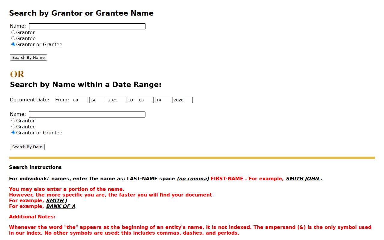
The form belongs at the index stage. A copy or certified instrument is the evidence stage, and a recorded deed still shows title activity rather than every person who used the address.
Kern County Criss-Cross Street Years
Historical address work shifts from modern parcel tools to paper directories. The Library of Congress holds Kern criss-cross material for Bakersfield, Lamont, and Oildale from 1954 through 1990. A broader nine-community run covers Bakersfield, Arvin, Delano, Edwards, Mojave, Rosamond, Shafter, Tehachapi, and Wasco from 1962 through 1990. The access route is an in-person paper-slip request, not a promise of an open web index.
Use the period street spelling and number. Find the street heading, scan the house numbers and cross streets, and check both sides when the volume's layout calls for it. If a number is absent, compare adjacent years before calling the building or household absent. The Kern County city directory page explains how the historical shelf, telephone books, and community codes fit together.
- Write down the exact volume, year, street heading, and page.
- Record the community label before treating a listed name as a Kern address match.
- Compare a criss-cross entry with a telephone or city directory entry.
- Use newspapers, obituaries, or probate to test a move or disappearance.
A historical directory records a publisher's canvass or subscriber list. It is strong evidence of a listed address at a point in time, but it is not a complete occupancy record.
Kern County Street Address Permit Clues
Permit records follow jurisdiction. Kern County is not a city, so first determine whether a parcel lies in Bakersfield, another incorporated place, or an unincorporated area. The official Bakersfield building permit application is a useful inventory of likely file fields, but the research did not verify a public permit-results or code-case portal.
The form asks for a project address, suite or building number, planning review number, business, APN, parcel map, tract, phase, and lot. It also has fields for an architect or engineer, owner, owner-builder status, contractor, work description, applicant role, and signature or date. License, phone, address, and expiration fields appear for the design and contractor roles. Owner information is required, and contractor information is required before issuance when the work is not owner-builder work.
- Use the city or county custodian that covers the parcel.
- Ask Development Services Building Division at 1715 Chester Avenue or 661-326-3720 about the request route.
- Use a CPRA request for an identifiable existing file, date range, address, or APN.
- Read a permit as evidence of a project and named participants, not as proof of later occupants.
Online department pages, a counter or phone call, a written request, and the Beale or archive route each solve a different gap. The permit application establishes what a file may contain; it does not establish that a searchable results database exists.
Kern County Street and ZIP Place Mismatches
A postal city does not always identify a municipal boundary. Oildale can use a Bakersfield postal name under ZIP 93308. Rosedale and Greenacres appear with Bakersfield under 93312. ZIP 93307 includes southeast Bakersfield as well as Greenfield, Weedpatch, and unincorporated places. Use USPS to verify the preferred mailing city and ZIP, then use GIS or official jurisdiction evidence to choose the right permit or records custodian.
The same problem appears outside Bakersfield. ZIP 93268 groups Taft, Ford City, South Taft, Taft Heights, Derby Acres, Dustin Acres, and Valley Acres. ZIP 93240 groups Lake Isabella, Mountain Mesa, South Lake, and Squirrel Mountain Valley. ZIP 93225 combines Frazier Park, Lake of the Woods, and Pine Mountain. These are delivery geographies, not proof that every address shares one city government.
Modern ZIP Codes began in 1963. A pre-1963 city directory, rural route, township, precinct, or legal description cannot be forced into a modern postal field. No official Kern ZIP split or realignment year was verified, so avoid turning a ZIP change into an unsourced claim about a street's history.
For an address-level mail check, use the USPS ZIP Code Lookup, then keep its output separate from the parcel and title record.
What a Kern County Street Directory Omits
A street directory can show a parcel, a recorded party, a permit applicant, or a historical subscriber. It does not show every person at an address. Deeds identify legal parties, not every adult or child. A return address may belong to a title company, lender, or attorney. A phone subscriber may not be the only person using a line. A permit's owner or contractor may not match later use of the property.
DMV address information is protected by the federal Driver's Privacy Protection Act, 18 U.S.C. §§2721 to 2725. Utility and delivery customer lists are not public directory sources. Protected voter addresses, confidential marriages, sealed or juvenile court matters, and Safe at Home participants follow separate limits. If a record is missing, the gap is part of the answer rather than an invitation to guess.
Lawful use. Kern County street and address records support personal, lawful research such as genealogy, property history, and civic review. Access never authorizes stalking, harassment, threats, or intimidation.
Use the relevant custodian for correction or clarification. The Recorder can index a release or later instrument, but it cannot rewrite an earlier document through an informal request. A careful street directory trail ends with a source note, a date, and a clear statement of what remains unknown.